Daily Weather Forecast
24 April 2026Announcement Date 24 April 2026
Forecast Additional Video Formats
General Situation
15 Feb 2023Image:
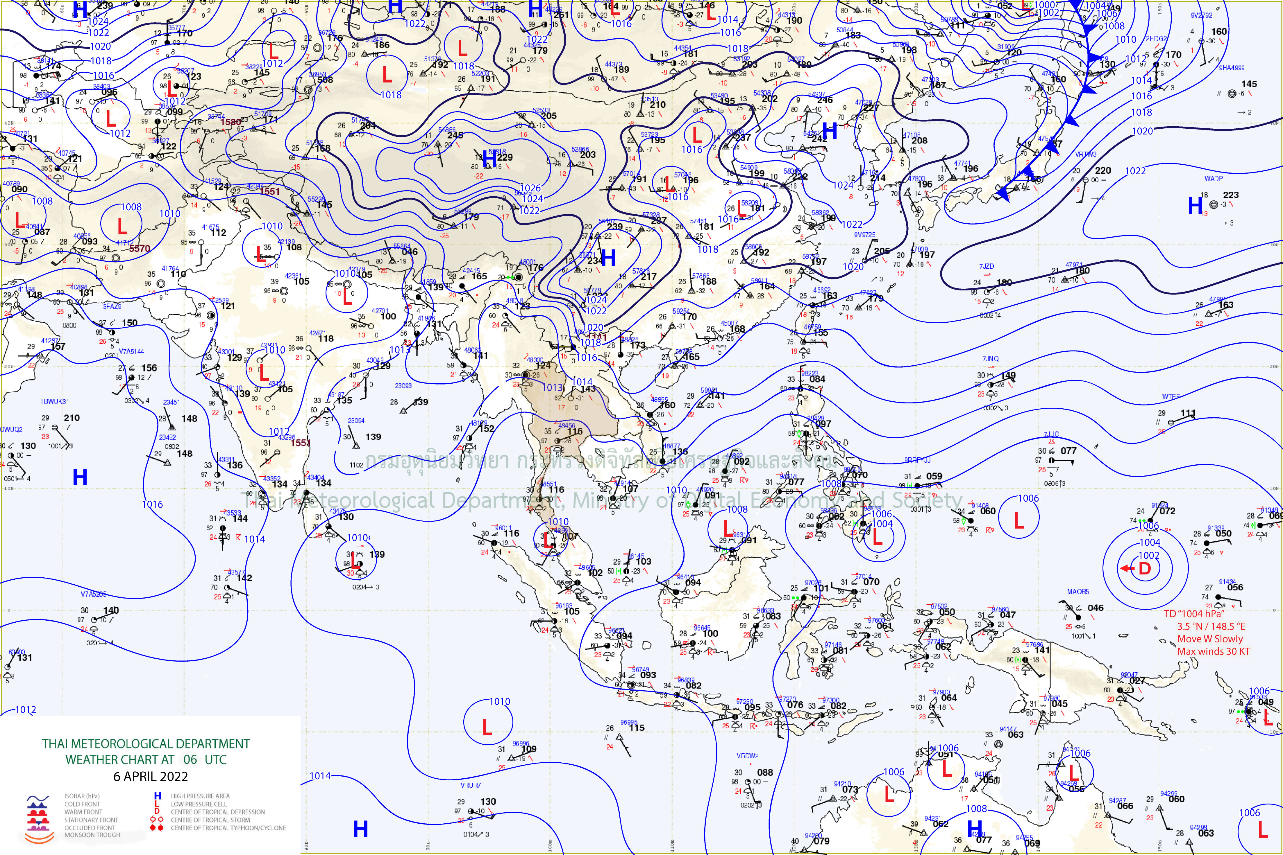
Weather Map
The moderate high pressure system covers upper Thailand with morning cool. People should keep healthy and beware of fire. The northeast monsoon and the easterly wind prevail across the Gulf of Thailand and the Andaman Sea with isolated thundershower in the South. The weakening wind forces the waves in the lower Gulf 1-2 meters high and in thundershowers more than 2 meters high. All ships in the lower Gulf should proceed with caution and keep off thundershowers. From 24 to 28 February, the intense high pressure system from China will extend to upper Thailand and the South China Sea with cooler condition. The temperature will decrease by 2-5 °C with strong winds. In another part, the northeast monsoon across the Gulf and the Andaman Sea will become stronger with more rain in the South. Isolated heavy rains are also possible. The wind is rather strong forcing the waves 2-4 meters high in the Gulf and more than 4 meters high in thundershowers. The waves in the Andaman Sea are likely 1-2 meters high.
Bangkok Metropolis and Vicinity Forecast
06:00 Today - 06:00 TomorrowThe moderate high pressure system covers upper Thailand with morning cool. People should keep healthy and beware of fire. The northeast monsoon and the easterly wind prevail across the Gulf of Thailand and the Andaman Sea with isolated thundershower in the South. The weakening wind forces the waves in the lower Gulf 1-2 meters high and in thundershowers more than 2 meters high. All ships in the lower Gulf should proceed with caution and keep off thundershowers. From 24 to 28 February, the intense high pressure system from China will extend to upper Thailand and the South China Sea with cooler condition. The temperature will decrease by 2-5 °C with strong winds. In another part, the northeast monsoon across the Gulf and the Andaman Sea will become stronger with more rain in the South. Isolated heavy rains are also possible. The wind is rather strong forcing the waves 2-4 meters high in the Gulf and more than 4 meters high in thundershowers. The waves in the Andaman Sea are likely 1-2 meters high.
Announcement Date 15 February 2023
Weather Province Additional
7 days Weather Forecast
October 16, 2022 - October 22, 2022Forecast
During 16 – 20 Oct, another rather strong high-pressure system from China will extend to upper Thailand and the South China Sea. Less rains, morning cool and strong wind are likely in the upper country. Resulting 2 - 4 °C drop in temperature is likely in the North and the Northeast, and 1 - 3 °C drop in temperature is likely in the Central and the East. Meanwhile, the monsoon trough lies across the middle South into the low-pressure cell over Bay of Bengal with continuous rainfalls and isolated heavy rains in the South. During 21 – 22 Oct, the rather strong high-pressure system over upper Thailand and the South China Sea will weaken. Increasing in temperature with morning fog and isolated rains are likely in the upper country. The moderate wind and wave in the gulf and the Andaman Sea are 1 - 2 meters high and above 2 meters high in thundershowers throughout the period, except during 17 -18 Oct, the rather strong wind force the waves in the upper Andaman Sea up to 2 - 3 meters high and above 3 meters high in thundershowers. Severe tropical storm “NESAT” at north of the Republic of the Philippines is expected to intensifiy and move to South China Sea during 16 Oct, which will past through southern part of Haina isle before make landfall on northern of Vietnam during 19-20 Oct and rapidly subside.
Announcement Date 17 Oct 2022
7 day Weather Summary
July 10, 2023 - July 16, 2023 อิม TestingForecast
The monsoon trough lay across Myanmar and upper Laos toward a low pressure cell over upper Vietnam on the first day of the period. Then it moved southward to lie over northern, upper central and northeastern parts on 17-18 Sep. The monsoon trough moved northward to lie over upper Laos and upper Vietnam on 19-20 Sep. and then moved southward to lie over northern, upper central and northeastern parts during end period. In addition, the southwest monsoon which prevailed over the Andaman Sea, southern Thailand and the Gulf of Thailand was moderate almost the period. These conditions caused abundant rainfall over upper Thailand almost the period while the southern part received rainfall throughout the period especially along the west coast which had plentiful rainfall almost the period.
Announcement Date 13 Jul 2023
Previous
Monthly Weather Forecast
November 2022Forecast
Upper Thailand will be colder especially the northern and northeastern regions with some thunderstorms on certain days. For the mountain tops, mountain peaks, and mountain ranges, the weather is generally cold. This is because the high-pressure area from China will extend to cover the North and Northeast periodically. It will be mostly moderate power. the southern part It continues to rain heavily. especially the east coast from Chumphon down There are still thunderstorms in 60 - 80 percent of the area with heavy rain in many areas and very heavy in some places. This will cause flash floods and flash floods, as well as overflowing riverbanks in some places. For wind waves in the Gulf of Thailand will be strong. In some periods, there will be waves 2 - 4 meters high, while the Andaman Sea will have 1-2 meters high because the northeast monsoon still prevails over the Gulf of Thailand and the South. It will have strength from time to time. In addition, there will be a monsoon trough that lies across the central South in some periods. In addition, in some periods there will be an active low-pressure cell moving closer. and has a high chance of moving through the southern region.
Announcement Date 01 November 2022
